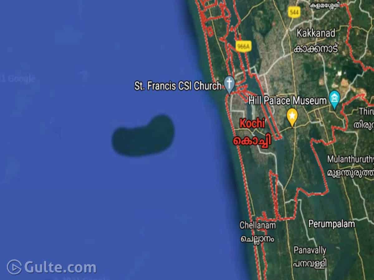
An underwater island-like structure near Kochi shore which is found on Google Maps has become a point of attention in Kerala right now. This island is in the shape of a bean and is half the size of West Kochi. Still, there is no visible structure in the sea as of now.
Kerala University of Fisheries and Ocean Studies (KUFOS) is currently researching the issue and is assuming the island to be an underwater structure. This structure first garnered attention when an organization called Chellanam Karshika Tourism Development Society wrote a letter to KUFOS.
In a Facebook post, the organization’s president advocate KX Julappan shared the screenshot of Google Maps where this island-like structure is visible. It is about seven kilometers away from the Kochi coast. According to Google maps, the structure had a length of eight kilometers and a breadth of 3.5 kilometers.
In a conversation with The News Minute, Vice-Chancellor of KUFOS, K Riji John, said that there have been many underwater islands that have been discovered across the world in the past.
However, it is still unclear about what this island is made of – sand or clay. He added that they can clarify it only after thorough research. The reason for its formation will also be known after the investigation.
Related Articles


Tags Kochi Island Kochi Underwater Island